Nigeria Gains Additional Maritime Territory About Five Times Size Of Lagos
POLITICS DIGEST- The United Nations has approved Nigeria’s submission, granting sovereignty over additional square kilometres of maritime territory.
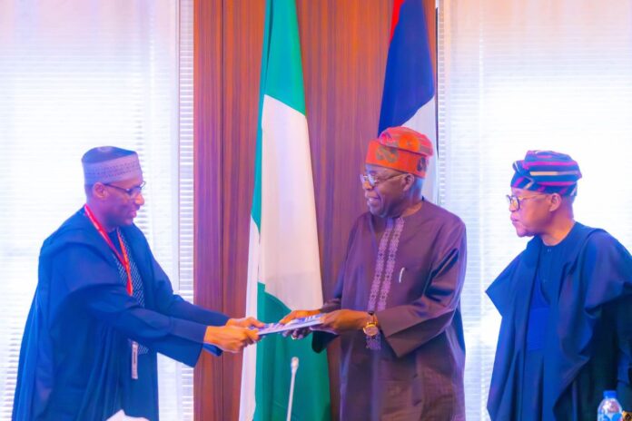
This was contained in a report submitted to President Bola Tinubu by the High Powered Presidential Committee, HPPC on Nigeria’s Extended Continental Shelf Project.
The President, in a statement released on Tuesday by his Special Adviser on media and publicity, Ajuri Ngalale, expressed his appreciation after listening to technical presentations by a marine scientist and member of the Committee, Professor Larry Awosika and HPPC Secretary, Surveyor Aliyu Omar.
“Today, it is a great honour for me to receive this report. I have listened attentively to this very specialised report, and I know it took a whole lot of effort to get to this stage. “
”We lost nothing but have gained great benefits for Nigeria. We will pursue the best option for the country,” Tinubu said.
According to the statement, the experts have been involved in the project since Nigeria’s initial submission to extend its continental shelf to the United Nations Commission on the Limits of the Continental Shelf, CLCS in 2009.
The area according to Surveyor Omar, approved for Nigeria is about 16,300 square kilometres, which is about five times the size of Lagos State’’.
Read Also:
He added that the official notification of the decision was conveyed to Nigeria by the UN Nations Commission on the Limits of the Continental Shelf, CLCS in August 2023, shortly after President Tinubu assumed office.
Omar outlined the available options for Nigeria following the approval:
”The first option is to take the area gained and finalise the registration with the UN Secretary-General and close everything, meaning that we are satisfied with what we got. This will take at least one year.
”The second option is to take what we have right now, acquire more data, do a support write-up, and make a revised submission as recommended by CLCS for further consideration. This will take another four years.
”Either way (options), Nigeria will keep what has been approved.’’
In his presentation, Professor Awosika explained that the approval came after years of meticulous scientific research on geophysics, geology, geography, and diplomatic efforts, which solidified Nigeria’s legal rights over a vast expanse of seabed and subsoil beyond its traditional territorial waters.
Awosika highlighted the economic potential of the newly acquired territory, which includes hydrocarbons, gas, solid minerals, and a wide variety of sedentary species.
He, however, cautioned against total disclosure of sensitive data acquired during surveys, noting that this will jeopardise confidentiality as Nigeria is expected to monetise the information to recover project expenses.
In attendance was the Minister of Marine and Blue Economy, Adegboyega Oyetola.
The project, aims to extend Nigeria’s maritime boundaries in accordance with the United Nations Convention on the Law of the Sea, UNCLOS, 1982.


